One of our favorite trails to hike at Shenandoah National Park was the Rose River Trail. This was the only trail in Shenandoah National Park the we hiked multiple times.
The trail is about a 3.5 mile loop. The easy part of the trail is the fire road which runs from Skyline Drive at the Fisher Gap Overlook down to the bottoms of Dark Hollow Falls. Which is a bonus for this hike. You get to see to waterfalls on basically one trail.
In my opinion, there are two routes you can take on this trail, if you start at the Fisher Gap parking area. The “mostly downhill” path or the “mostly uphill” path. Okay, yes, it is both uphill and downhill that you must hike. However, you can choose whether to take the steeper portion with switchbacks going down or up.


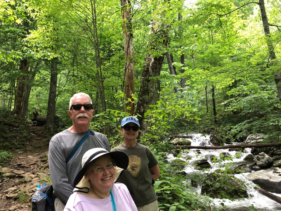
From Fisher Gap, the fire road will lead straight downhill towards Dark Hollow Falls. This is a gentle hike downhill. Gayle likes walking uphill on the fire road as it is the less strenuous path back up to the car from the falls. Along the fire road, about half way is the Cave Cemetery. Based on the headstones, I believe it is the cemetery of a family named Cave. Some of the headstones are confederate soldiers and more recent ones are their other relatives, I assume. Also along the fire road is where we tended to come across a mother bear and her two yearlings. We always stopped to watch them as the meandered across our path, playing us no attention. Our friends Ann & Steve almost ran right into them as we were hiking down the road.

At the bottom the of the falls, you meet up with the Dark Hills Falls trail. You can hike the trail about a tenth of a mile up, literally, to where the main falls are. If you want you can go further to the top of the falls, but I am too lazy and never went further up. Ann & Steve told me it was okay, but the point where I stopped was better.


When you get back to the bottom of Dark Hollow Falls, you hike across a short metal bridge and resume the Rose River Trail. It follows along the Rose River, gently descending as you go towards the river. Be advised that this portion of the trail has many rocks and roots that reach out to trip you with every step. In general, the path can be wet and there will be a downed tree or two that you will scramble over.


Gayle commented that going along the trail down river, you miss many of the cascade views that you would see if you were traveling the other direction. But you can always turn around to capture the views of the cascades with your camera.
Just before the halfway mark, you will come to a bridge to cross the river. Don’t be fooled into thinking you will have dry feet for the entire hike. Soon after the bridge crossing you will need to ford a stream. Depending upon the rain levels you will either be able to cross the stream atop rocks that are slightly above or at the water level, or you will just bite the bullet and wade into the stream. I guess you do have one other option and give up and turn around, but what fun would that be?


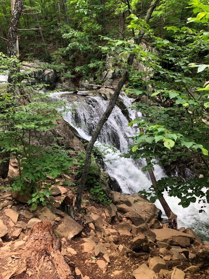
After wading the stream, you begin the climb back up to Fishers Gap. At this point you are now hiking up the river and no longer need to turn around to view the cascades. At about the time you come to the Rose River Falls you will realize that you are on the “mostly uphill” version of the trail. The best place to view the falls is at a rock outcropping where you are looking down at the top of the falls. I wouldn’t recommend trying to get to the bottom of the falls. It is extremely steep and would be extremely difficult to climb out of. And I am sure that you wouldn’t want to be the one that Search And Rescue needs to come carry out.
From the top of the falls, the trail veers away from the river in a series of switchbacks that eventually ends up at the fire road near your starting point.
My advice, take the “mostly downhill” version (take the horse trail) and return on the fire road. Either way, you will enjoy the hike.
